Survey Construction Procedures 1 – Fundamentals
$495.00 inc GST
This is day 1 of a two-day course in the use of 12d Model for Construction Surveying. This is a face to face training session at our North Sydney Training centre.
In this course you will learn how to use the tools available within 12d Model Software to the deliver the work required of an on-site Engineering Surveyor.
Loading 3d Digital Engineering (DE) data, interrogating and analysing information to produce a high quality project outcome
- Start Time: 1:00 pm
- End Time: 4:00 pm
- Date:Tues 14th, Wed 15th & Fri 17th May 2024
- Place: Online
5 places available
Survey Construction Procedures 1 – Fundamentals is part one of a two day 12d Model Training course about taking 3d Digital Engineering (DE) data, interrogating and analysing information to produce a high quality project outcomes.
Participants will become familiar with the techniques and tools within 12d Model to complete basic design requirements, volume calculations and conformance reporting. Aspects and outputs required by on-site Engineering Surveyors.
Prerequisites:
- Attend the ‘Introduction to 12d Model’ training course OR
- Complete the Premium version of our on-line training course ‘Introduction to 12d Model’ OR
- Experience gained in the workplace in the use of 12d Model for modelling surfaces and creating strings. If you claim workplace experience, you will need to complete on-line exercises to demonstrate your competence.
Outcomes
This session covers the procedures for taking electronic data collected on a Total Station or GPS unit, and reducing the data into 12d Model.
Steps covered include reducing the data, correcting miss-coded points and other field errors, manipulating the data into models (layers) with colours / linestyles / symbols applied.
You will be familiar with the use of a map file and label mapping techniques to output survey information to both PDF or CAD.
Course Outline
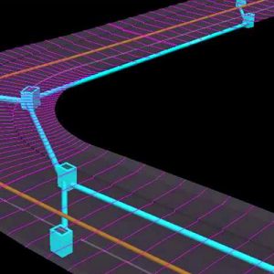
- Loading a design from a dwg file, and adding vertical road geometry and setout points.
- Use 12d Model’s design tools to create a dam, and the dam walls (batters) to the natural surface.
- Merge the design DTM with the natural surface DTM to create a ‘finished surface’ – a ‘Supertin’.
- Import design data from a GENIO file, and assign (map) the data into models and assign colours based on the code.
- Generate cross sections from the design strings.
- Create subgrade layers (boxing) for the road, and calculate subgrade volumes.
Further Training
For Civil Designers, the next course is Survey Construction Procedures 2 – Essential Techniques
Related products
-

Stormwater Drainage 3 – Dynamic Analysis
1:00pm - 4:00pm, Tuesday 4th, Wednesday 5th & Thursday 6th June 2024Online$495.00 inc GST Register Now -
Civil Design Features – MTF Decisionals
8th May 2024 1.00pm - 4.30pmOn-Line$242.00 inc GST Register Now -
Stormwater Drainage 1 – Geometric Design
Tuesday 14th, Wednesday 15th & Thursday 16th May 2024 1pm- 4pmOnline$495.00 inc GST Register Now -
Survey Construction Procedures 2 – Essential Techniques
Tuesday 21st, Wednesday 22nd and Friday 24th May 2024 1:00- 4:00pmOnline$495.00 inc GST Register Now